If, during the First World War, the recent mapping Michelin still has not been influenced by the conflict (except the excellent series of Michelin's illustrated guides to the Battlefiels whose first titles were published before the signing of the armistice). It is not the case during the period 1939 -1945, or fund Michelin known for its accuracy and quality of its updates was quickly put to use by the military.
By the early events, Michelin amends 4 maps near the north-eastern border.
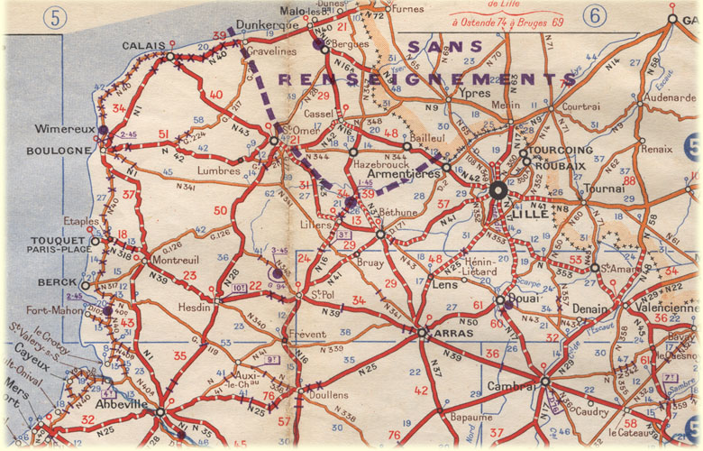
sheets 51, 53, 57 and 87.
The 53 and 57 have an extra fold half stuck to the right of the fold 20 for
53 and left the fold 1 for 57. And for the 4, the boundary is highlighted with
pink. The back of the envelope fold this text: Michelin maps currently required.
overview of the additions of sheets 53 and 57, in the center,
the text printed on the back additions.

Below the normal sheet 57 in 1939.

And below the sheet added with the borders underlined, this map is also without
the leaflet said.

The Germans were quick to use the potential of Michelin maps.
In 1940, they reproduce the maps of the 1938 edition of Michelin. These maps
are grouped into 4 pockets each shown a quarter of France, (see picture below)
and a serie for Belgium and Holland including the all new maps of Holland described
below.

The colors are identical to the original Michelin sheet, but some elements were
deleted: the green highlighting the "tourist route" and marks marks
intermediate distance. The indications on the margins have been simplified,
blue indicates an overload of the grid maps of "HQ" at the 80 000th.
3-folding is very impractical.
These leaves are numbered from 1 to 36, comprising a wide margin, which is deferred
under the area covered by the cover and the sheet name (identical to that of
Michelin). Bottom of the sheet is the distribution of the area covered by the
series of maps contained in the pouch with the numbers of leaves, the legend
directly copied from the original, but translated into German.
Below, differences between the German map (above) and model
( ed Michelin 1938 below)

One of the captions translated to the left, and the original right.


distribution of the kit II; Nordwest-Frankreich.


Note that the German sheet 14 is slightly higher than the others.
On remarque que la feuille allemande 14 est légèrement
plus haute que les autres. Comparing with the distribution of the Michelin
sheets on the right ,
we see that the German sheet fills the gap between the Michelin sheets 54
and 60, saving a lot in this serie.
The equivalent of the Michelin 55 is "4 blatt" which is part of
the lot "NO-Frankreich".
The sheet 14 is obtained by Michelin 60 + a strip cut off at the bottom of
the sheet 55, as shown below.


Some maps will come in 1940, they raise some questions among collectors to their origin. They are all printed with the cover on the fold 1.


map of England has had several editions between 1940 and 1941.
Editions that differ in the level of detail of the mapping.
In 1940 also appear 2 sheets covering the netherlands, these are 2 sheets with 3 different presentations for the same year.


The first sheet is dated March 1940, it is marked dressé et publiée
par le service géographique de l'armée,
but the design and symbolism are Michelin. The other 2 editions usually include
the words Dressée par Michelin et Cie.
The first 2 have the cover printed on the fold 1. Un pli supplémentaire
porte la légende et la seconde couverture.
For the latter, the fold 1 and half of the last fold has been deleted and
replaced with cardboard covers classic Michelin.
During the occupation period, the "demarcation" line
was plotted on maps 98, 99 and 9899 editions in 1940 and 1941.

Below, reproduction of sheet 98 and 99, 1941 maps, use the menu below the image to zoom and move around the map.
Throughout the conflict, the issuance of maps has been steady,
but because of the shortage of raw materials, some maps have been sold without
their cardboard cover.
In this case, a stamp at the top of the fold 1 recalls the imposed price .


In 1944, those who appear without cover being overweight printed on the first
fold that recalls the name of the publisher, numbers 51 and 52 which fold 1
is occupied by the sea take a reminder of the logo of the coverage or full coverage.
last 2 are printed in 2 colors only (black and blue) instead of the 5 colors
that usually used by Michelin.

Below details of the 52 map in 1944 printed in 2 colors, unlike the 51 the blue
sea hatching has been deleted.

At this time, it is not uncommon to renconter maps printed on the back of other
maps, or discarded in previous years, or maps for the German army, recovered
in printing.
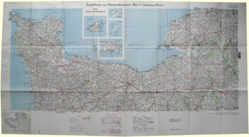
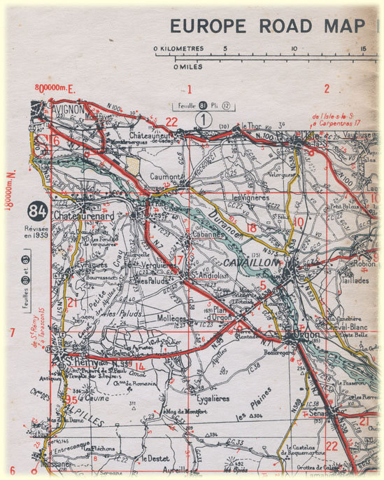
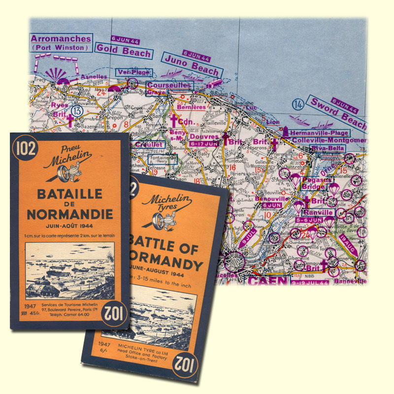
In view of the landing allies have largely used the wealth of
information that was mapping Michelin. GSGS (Geographical Section General
Staff) on conducting a series of maps of France, Belgium and Holland directly
copied from the Michelin maps : colorization was simplified (the green disappears),
a grid is added (Gridlines "Lambert" for France, but the border may
have a different grid) Large margins are added, with a caption in English, a
scale in kilometers and miles, some indications of use, the list of adjacent
maps, especially the method of folding ..(which is the practice folding patented
by Michelin). These sheets will retain the numbering Michelin.
below the 84 sheet Marseille - Menton

Above angle top / left of the sheet"war Office" 84 .
Below entries at the bottom of the sheet 78.
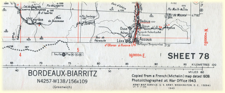
Restrictions of Lambert grids for France and that used by Americans in Germany
listed on sheet 62.

For traffic in the cities, there are the plans of the Red Guide
which have been used,they are grouped in a series of 6 small books, each covering
a region of France. There is even a version where each map is placed next to
an aerial view of the town.


These booklets can be grouped and protected in a large bag oilcloth. The officers
also received a copy of the 1939 Red Guide "reproducted" by the War
Office.
There are also reproductions of the 1944 pre-war maps made by SGMA (?). Printed in black only on poor paper, each sheet does not reproduce that half a Michelin map, folding inconvenient is 5 and half folds. The legend is reproduced on the first folder.


Details fold 1 79map, it is the reproduction of the 1936 sheet.

In 1945, 7 new maps appear, the 162 and 163, West Germany and
East at 1 000 000 th (the East can be only one year)
and 202 to 206 to 200 000 th overall, covering the French occupation zone and
will be edited until the early 80
Part of the 163 were manufactured by recycling maps planned
for the German invasion of England.
On it a statement reads:"They had planned the invasion of England,
and printed the map is back.
But ... they had not anticipated that we would use the other side to print a
map to invade their country."

At the end of war, many bridges and roads were destroyed or
damaged, a series of maps "routes rapides", who appeared before war
was renamed "routes et ponts", it proposes to make the "inventory
of barriers to movement on the road network. The first edition was published
in January 1945 and will be followed by 3 updates in April, June and August
of that year, then 2 in 1946, and an annual publication until 1951.

Legend affixed to the first editions "Routes et Ronts" of
1945.

Extract from the sheet 96 Routes et Ponts
above extract from the sheet 51 , 1945, 1945 2 et 1946


 En Francais